|
The Impact of U.S. Aerial Reconnaissance during the Early Cold War (1947-1962): Service & Sacrifice of the Cold Warriors Chapter 2 The Need to Know First Reconnaissance Missions: The first F-13 missions were flown to conduct photo intelligence (PHOTINT) mapping and charting and visual reconnaissance. After WW II, SAC’s F-13 photo-reconnaissance aircraft helped capture the airborne data from the U.S. atomic tests at the Bikini Atoll. Later, it was called upon to begin PHOTINT missions in the Arctic and along the Northern Soviet Coast. This effort, named Project NANOOK, was the Cold War’s first Top Secret reconnaissance effort. As reported by one of the participants, Fred Wack:
As national leaders became more concerned about the threat of Soviet attack from Siberian bases, the AAF flew additional PHOTINT missions from Alaskan bases. Intelligence reported the Soviets had developed a new generation of bombers which could bring the U.S. under direct air attack if flown from these Siberian bases. On 8 April 1948, the first Secretary of the Air Force, Stuart Symington, sent a short note to General Spaatz:
Beyond this request from the Secretary of the Air Force, SAC needed to know about Soviet defenses in the region for war-planning. As a result, the 46th (renamed the 72nd) Reconnaissance Squadron (RS) began a series of PHOTINT missions along Chutskoi Peninsula under Project LEOPARD. This unit later expanded to other missions code-named RICKRACK, STONEWORK, and COVERALLS. By October 1949, over 1,800 pictures had been produced. (35) Some of these reconnaissance missions used oblique, side-looking high-powered cameras which enabled the reconnaissance aircraft to look into the Soviet Union as the reconnaissance mission flew a few miles over the international boundry–usually along the coast. Some of these RB-29’s had their gun turrets and armament stripped off to allow the aircraft to reach airspeeds in excess of 350 mph while still at 25,000 feet. (36) |
||||||
 |
||||||
|
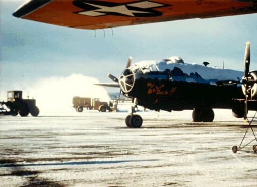
F-13/RB-29 on Ladd Field Ramp, Alaska, Source: Ken White, World in Peril publication, accessed via Internet URL htpp//www.whiteandassoc.com/gallery, 2/2/03 |
||||||
| Yet other missions were configured to begin ELINT collection along the Soviet coast. These early ELINT missions were ordered as the PHOTINT mission verified increased Soviet activity and construction in the Soviet Far East and Siberian areas. SAC ordered specially-configured ELINT RB-29 aircraft which could sample the area for signs of improved Soviet radar defenses.
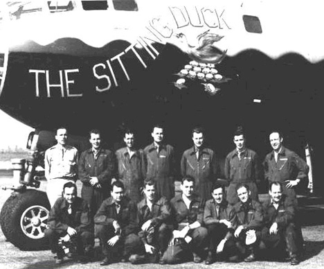
The first completely ELINT–configured RB-29, named “Sitting Duck” by its crew, began missions along the northern Soviet coast in June 1949. Between June and August, the aircraft flew eight operational missions totaling over 100 hours. (37) |
||||||
 |
||||||
|
|
||||||
|
In July 1949, Paul R. Horton flew out of Ladd AFB, Alaska on some of these missions as an electronic countermeasures officer aboard an RB-29 of the 91st Strategic Reconnaissance Wing (SRW). He recalled:
|
||||||
|
Attributions (33) Fred J. Wack, The Secret Explorers: Saga of the 46th/72nd Reconnaissance Squadrons (N.p., 1990), End of Page 4 of 5 Pages, Chapter 2 — Go to Page 5 You may go to Page — 1 — 2 — 3 — 4 — 5 — this chapter or you may go to Cover Page — Editor’s Introduction — Overview Acknowledgments — Table of Contents Appendixes — A — B — C — D |
||||||