The Story Of One Of The 91st SRS COs,
|
|||||||
| I reported into the 3rd Photo right after July 4th, 1942. Within a week I was copilot for my squadron C.O.,then Major Robert Dodson on a flight to Guatemala City. At the time, the squadron had several ranking officers, Commanders (Lt. Colonel equivalent) on loan from the US Coast and Geodetic Survey. They were responsible for obtaining the ground positions to tie in with aerial mapping photos needed to produce accurate maps. We had one of these Lt. Colonel’s aboard our A-29. He had sent a lot of geodetic equipment, mostly theodolites, from Brownsville, TX, a month earlier to Guatemala City by Mexican railroad! A month later, they were still in Mexico, supposedly at the border with Guatemala. He was to get the equipment, bring it to Guatemala City where we would fly it back. After 4 or 5 days, he had not returned from the border and we were ordered back to MacDill. A week after my return, I flew an F-2 with a photographer and a crew chief to Porto Prince, Haiti via Camaguez, Cuba, where I relieved then Lieutenant Doug Steakley. I spent the next month mapping parts of Haiti and the Dominican Republic. Haiti was and still is a very poor country. Three products: Haitian rum, mahogany bowls and sisal grass handbags were in demand back at our squadron. So when I returned to MacDill, the plane was full of jugs of Paul Gardere’s Special Reserve Haitian rum, lots of Haitian mahogany, and sisal grass handbags. We stopped in Nassau in the Bahamas on the way to add a few cases of good scotch to the load. |
|||||||
| After a week or so back at MacDill, we flew 3 F-2s to Brazil via Guantanamo Bay, Cuba, Bourenquin Field and Ponce, Puerto Rico, Santa Lucia, Trinidad, British Guiana, and Dutch Guinea to Belem. We spent the next three months mapping all of the coastal regions, the air route to Rio from Belem and a hundred mile wide swath up the Amazon River to Manaus where the Ford Motor Co had a very large rubber plantation. The existing maps around the Amazon River delta were very inaccurate in 1942, which was one of the primary reasons we were in Brazil. The mouth of the Amazon was very wide and composed of many islands formed by silt deposits that changed their shapes from what then existing maps showed. A check point north of the delta that was being used by crews ferrying aircraft across the South Atlantic to Africa were in error by almost 100 miles. The result was many planes, mostly B-24s, were lost in the jungles south and west of Belem. Belem had only a low powered radio beacon. Low ceilings and rain were the afternoon norm. (Note: Aircraft getting lost were enroute to Belem and then flyingon to Natal, Brazil and across the South Atlantic to Africa.) |
|||||||
 |
|||||||
|
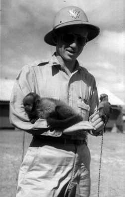
Brazil, 1942 |
|||||||
| We operated from not only Belem and Manaus but also Sao Luis, Fortaleza, Natal, Recife, Bahia, Terrazina and Rio. In December. I flew a “war weary” F-2 back to MacDill arriving a week before Christmas. TDY orders to Peterson Field, Colorado Springs, CO with 7 days delay enroute awaited me. I was to check out at Peterson Field in the photo version of the B-25, the F-10, return to MacDill and check out the squadron in the F-10s we were due to receive starting in late January 1943. |
|||||||
 |
|||||||
|
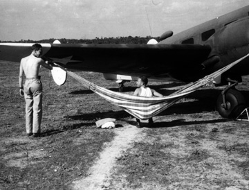
Clarence Becker anbd Murry Schott, roughing it at Terrazina, Brazil, November 1942 |
|||||||
|
End of Chapter 4 — Go To Chapter 5 1 — 2 — 3 — 4 — 5 — 6 — 7 — 8 — 9 — 10 — 11 Cover Page — Introduction — Table of Contents Or you may go to Home - Contact Us - Cold War Hist. - 91st SRS Hist. - Stardust 40 Mission Story |
|||||||